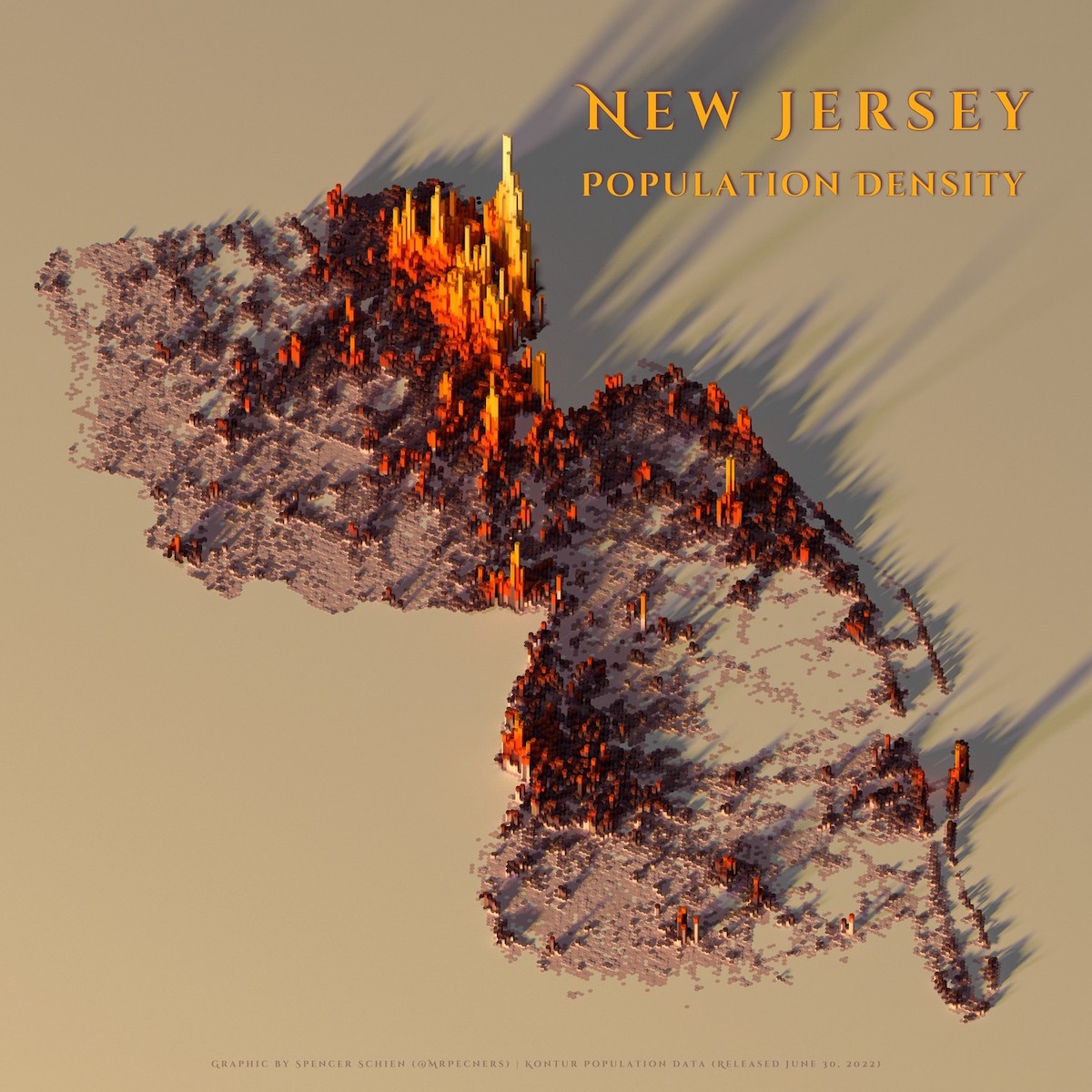
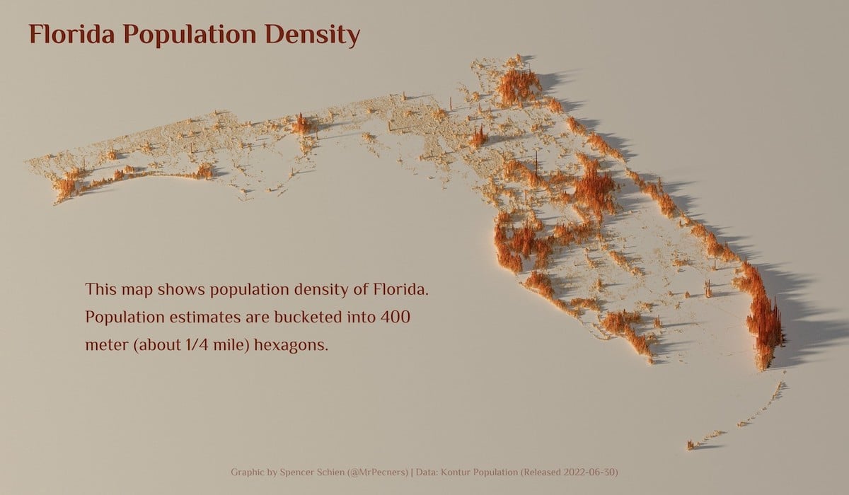
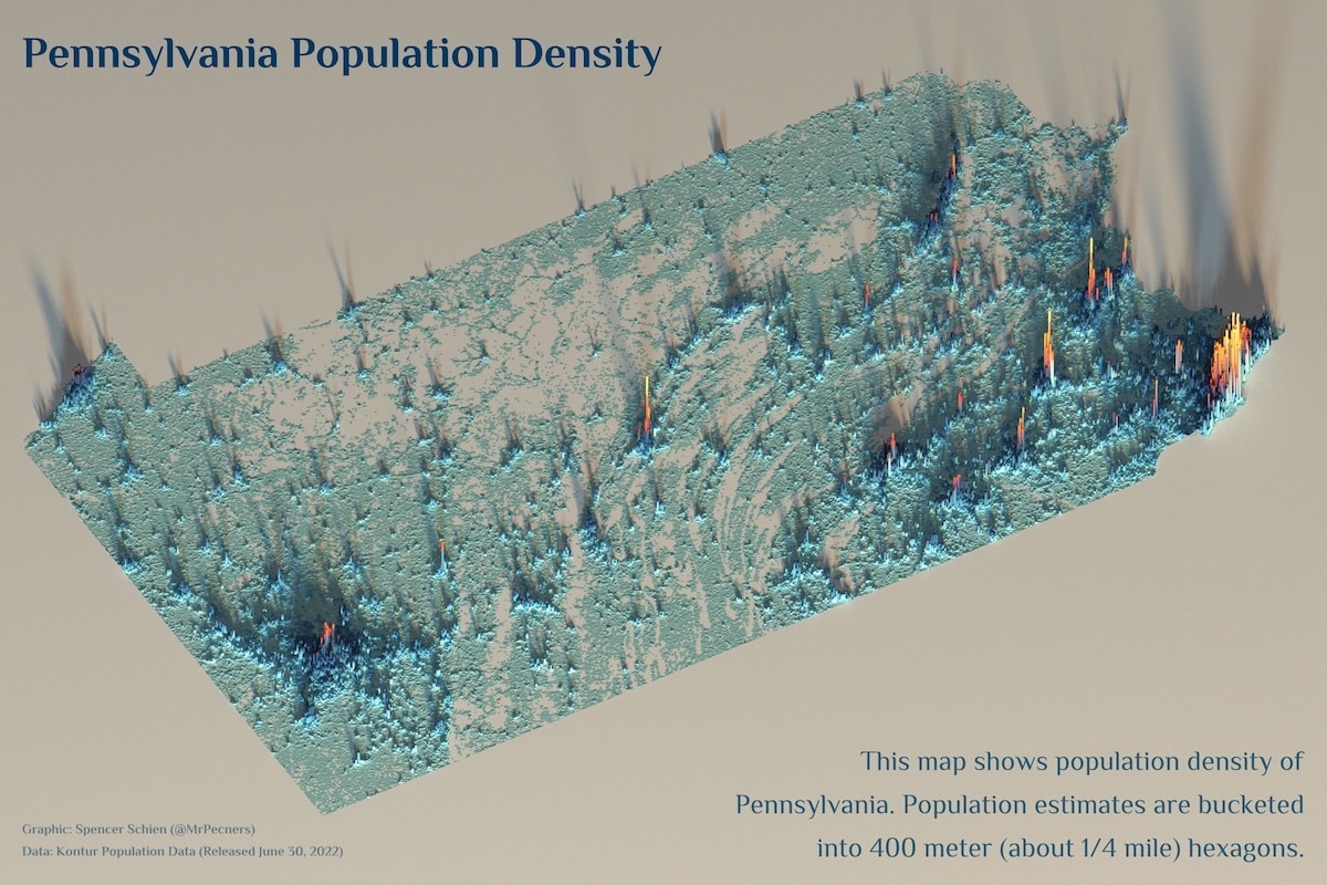
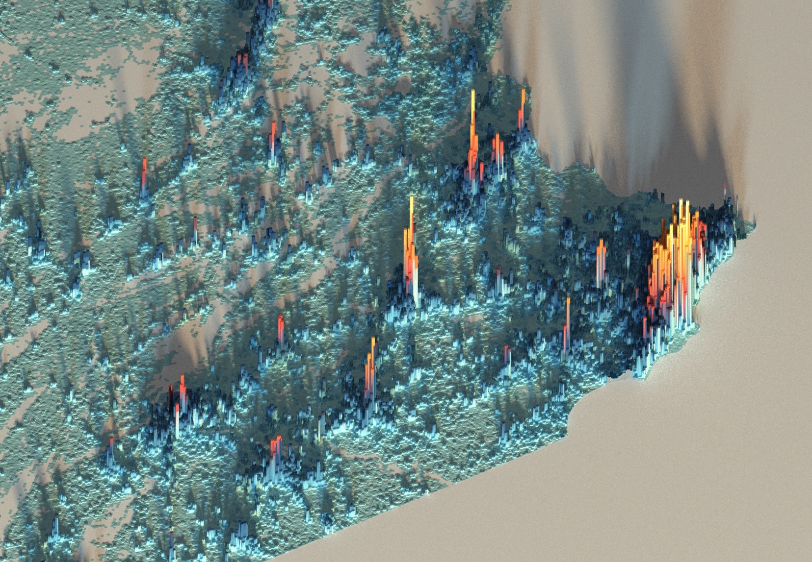
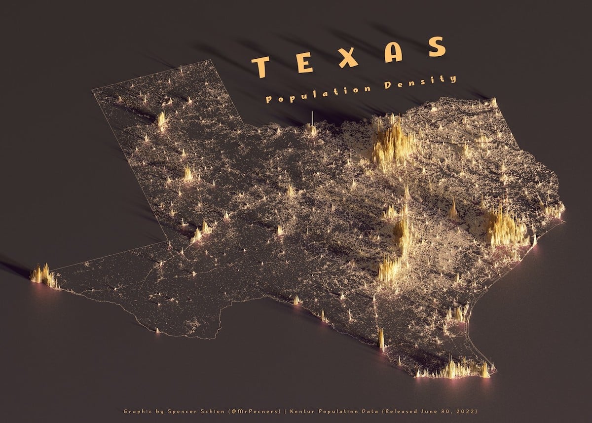
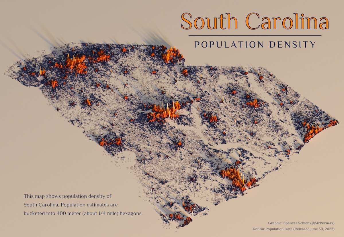
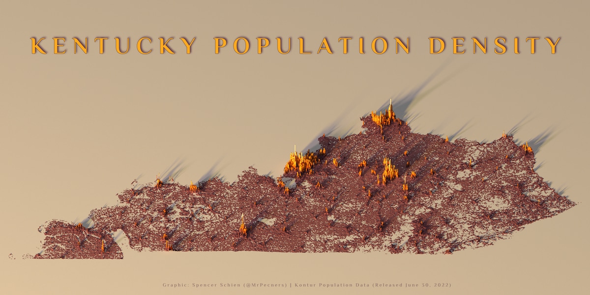
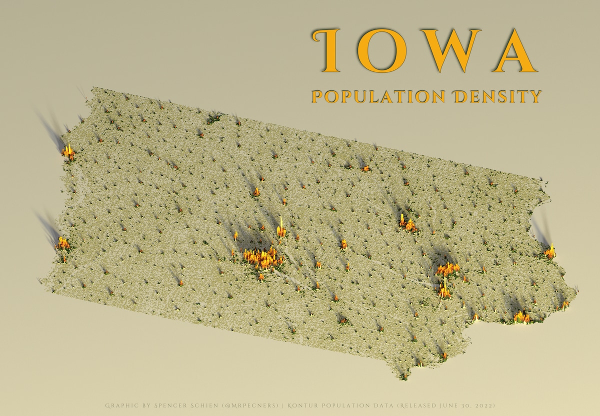
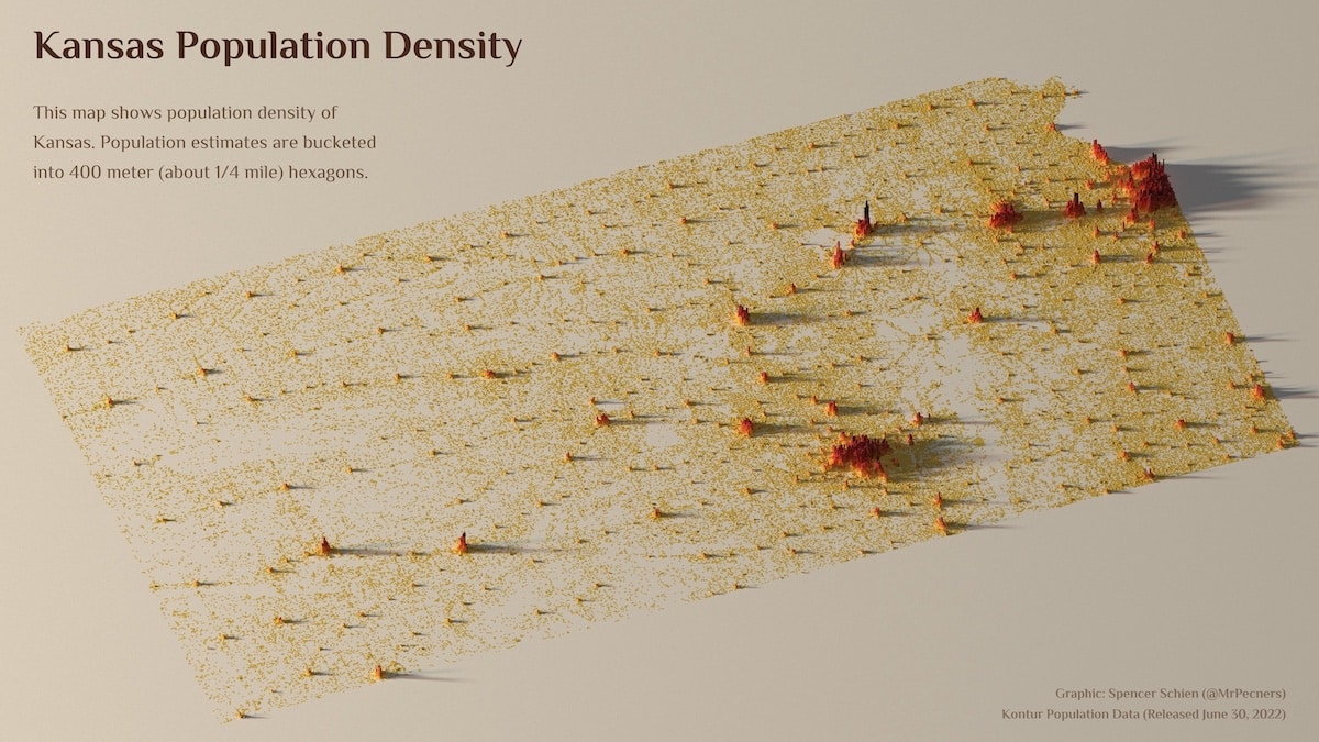
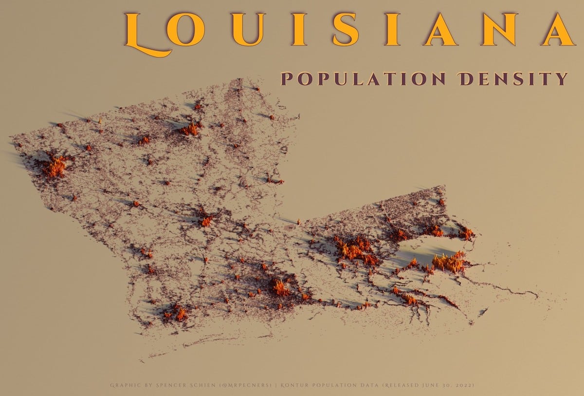
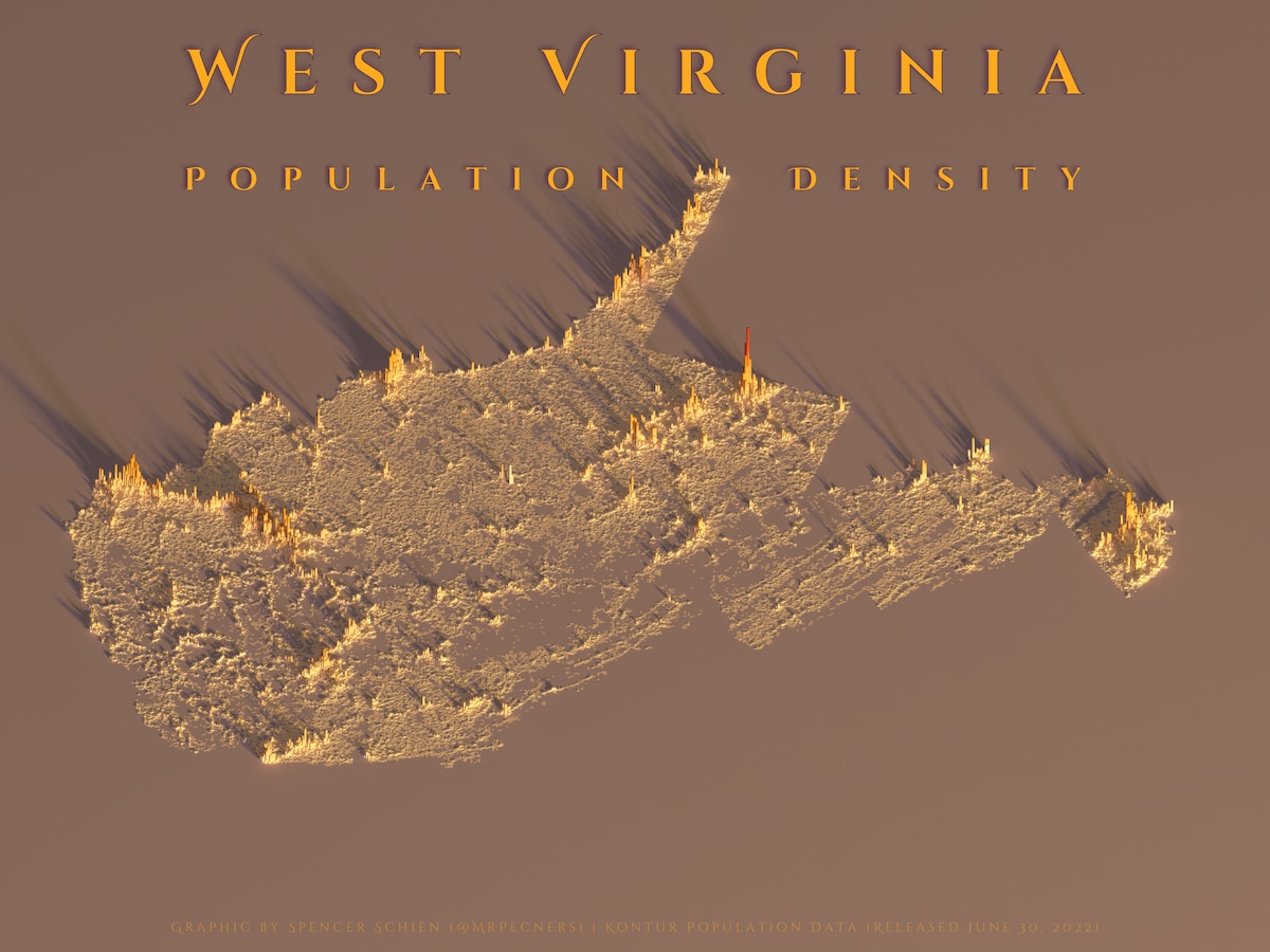
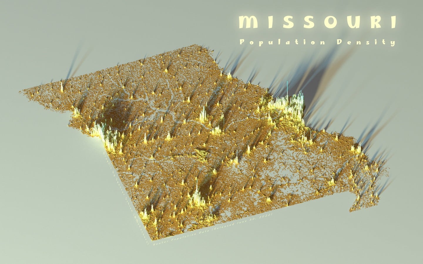
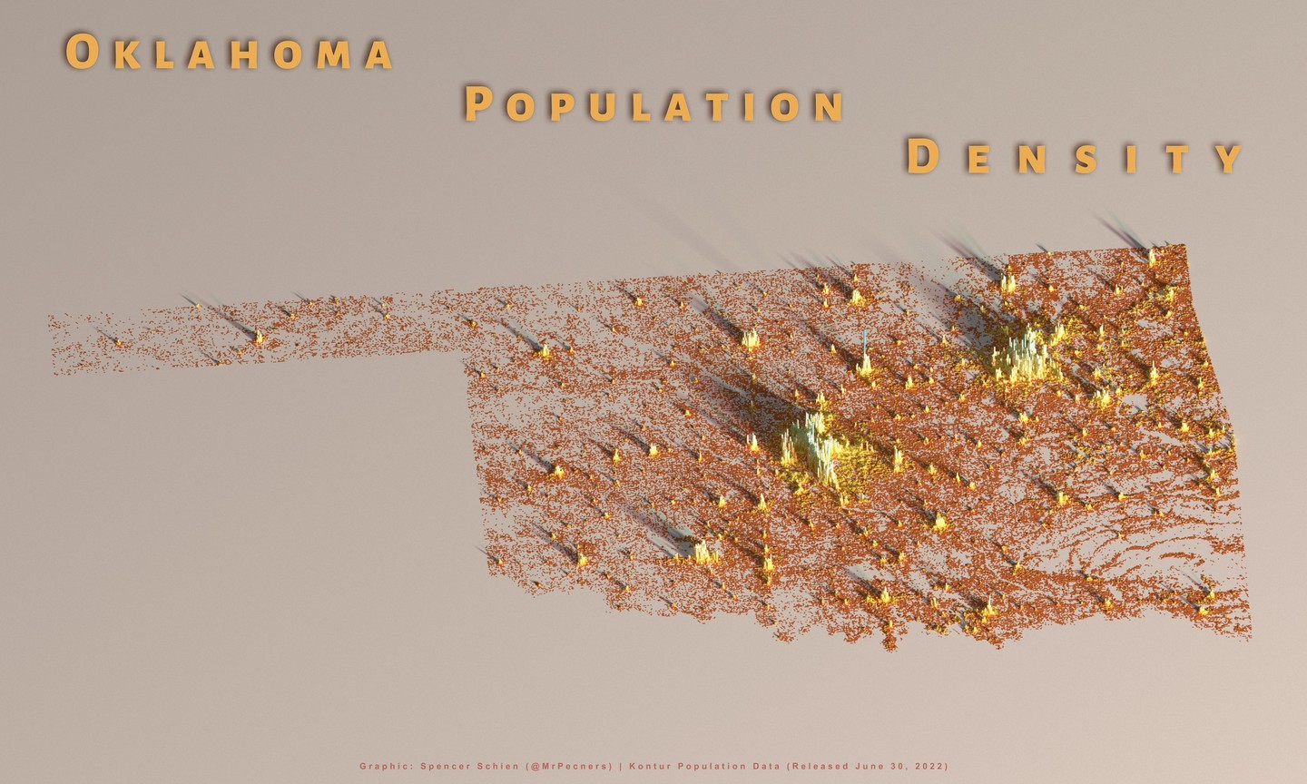
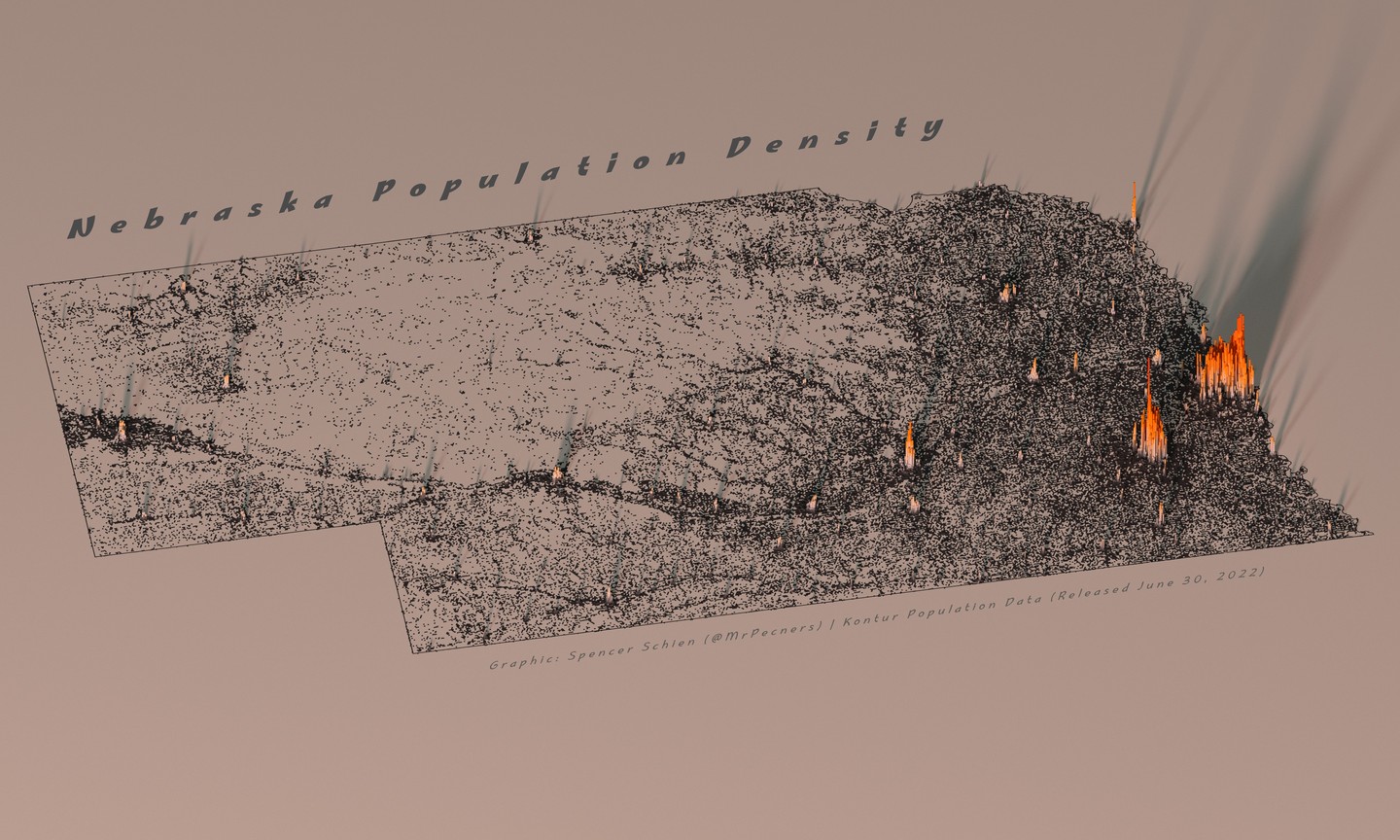
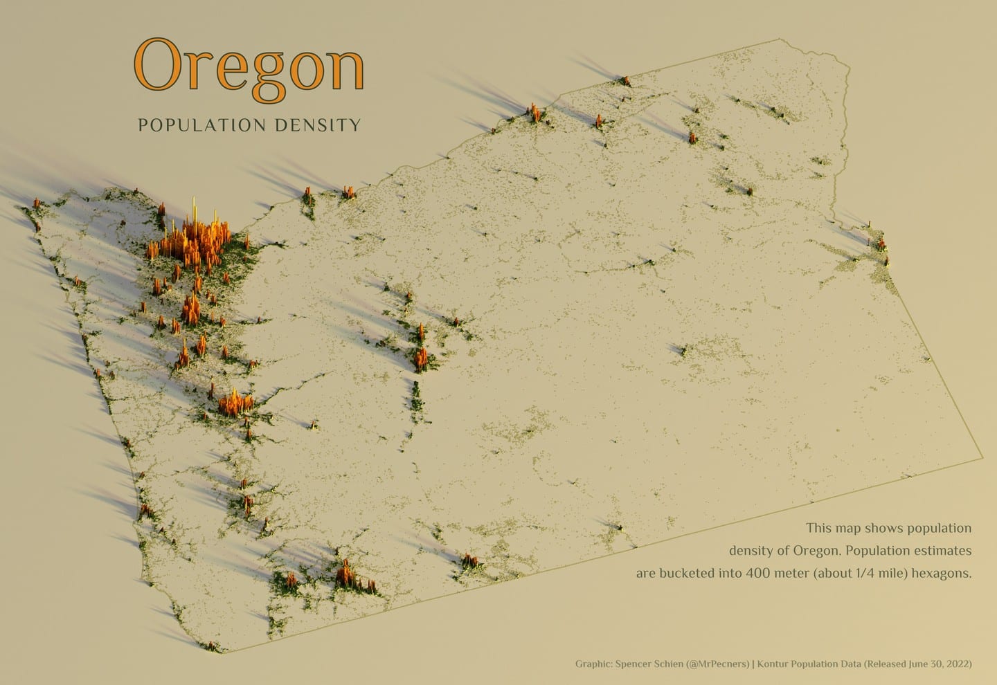
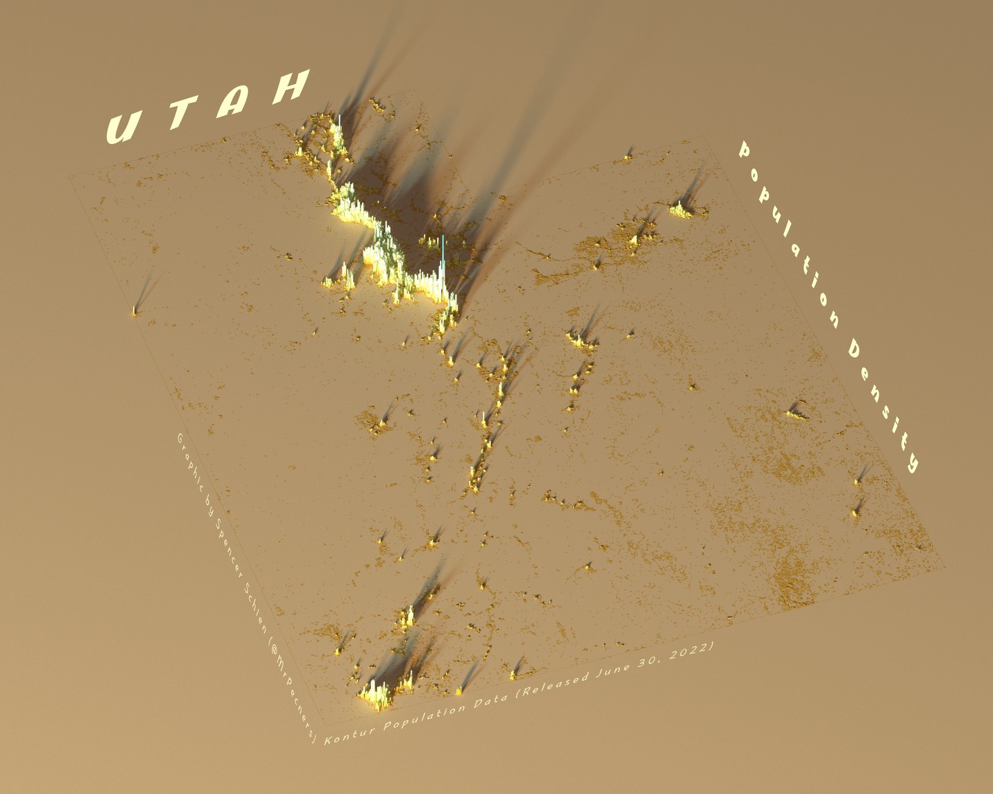
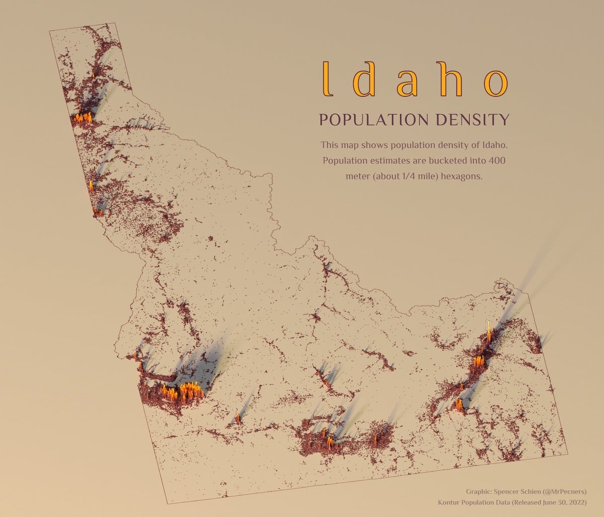
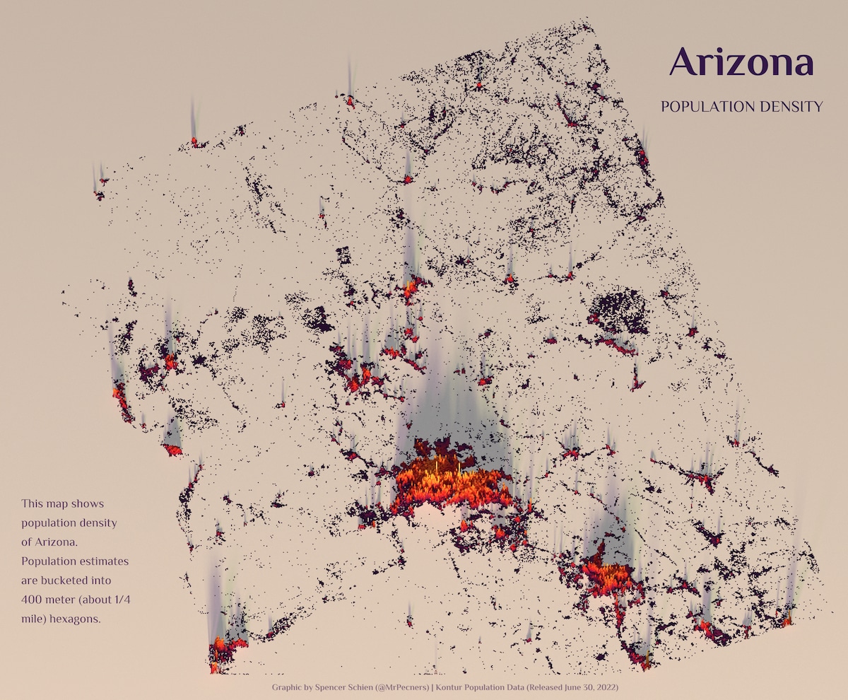
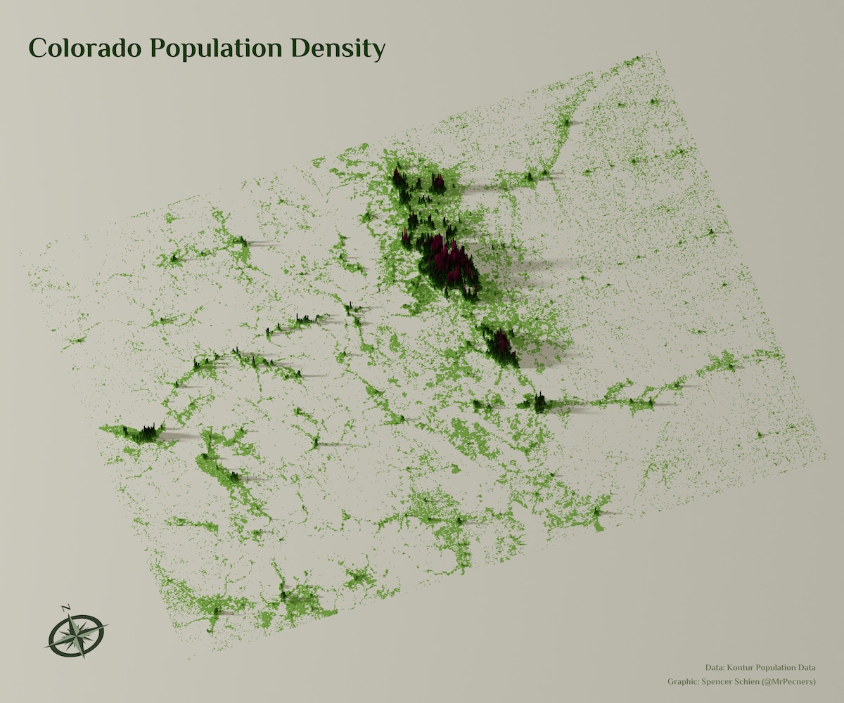
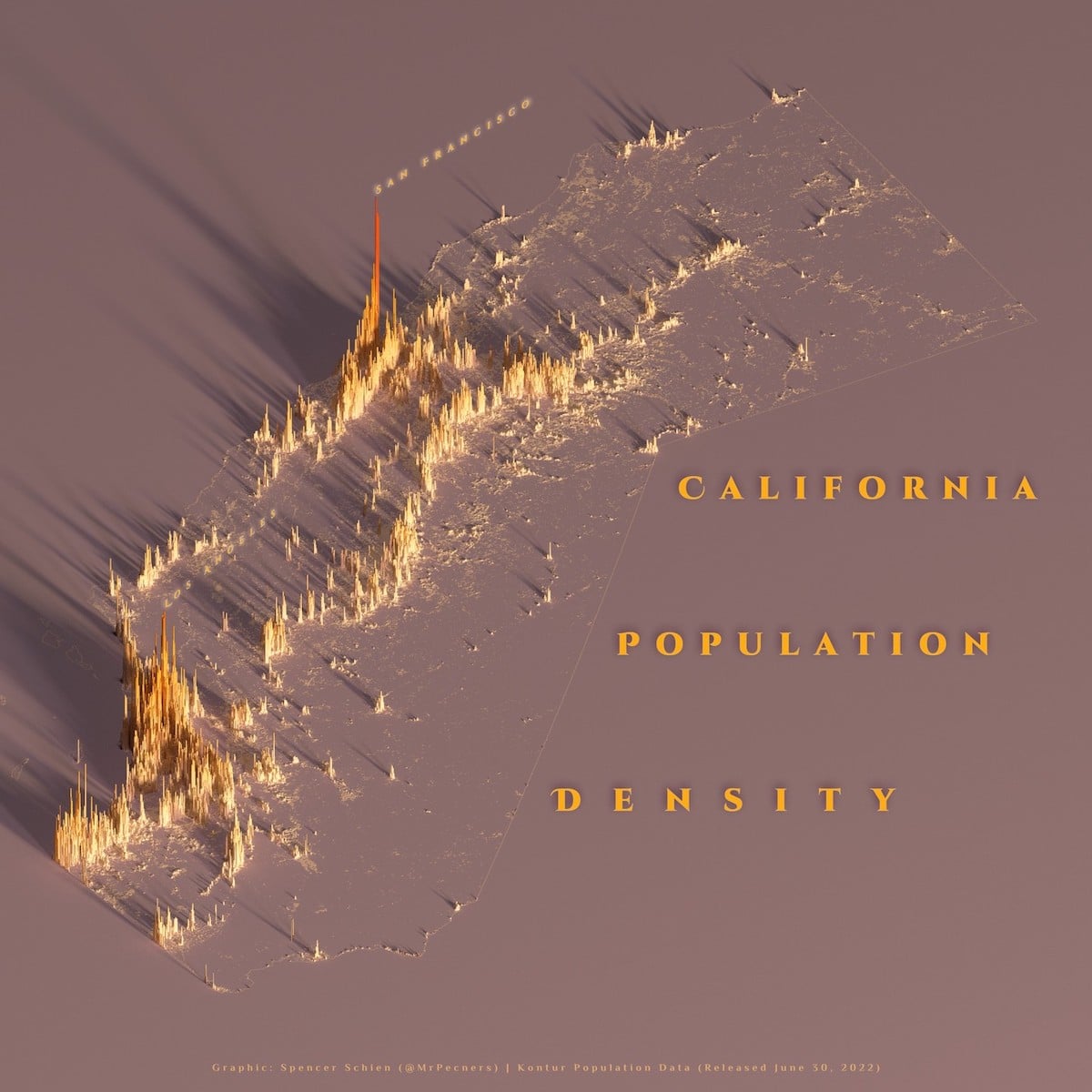
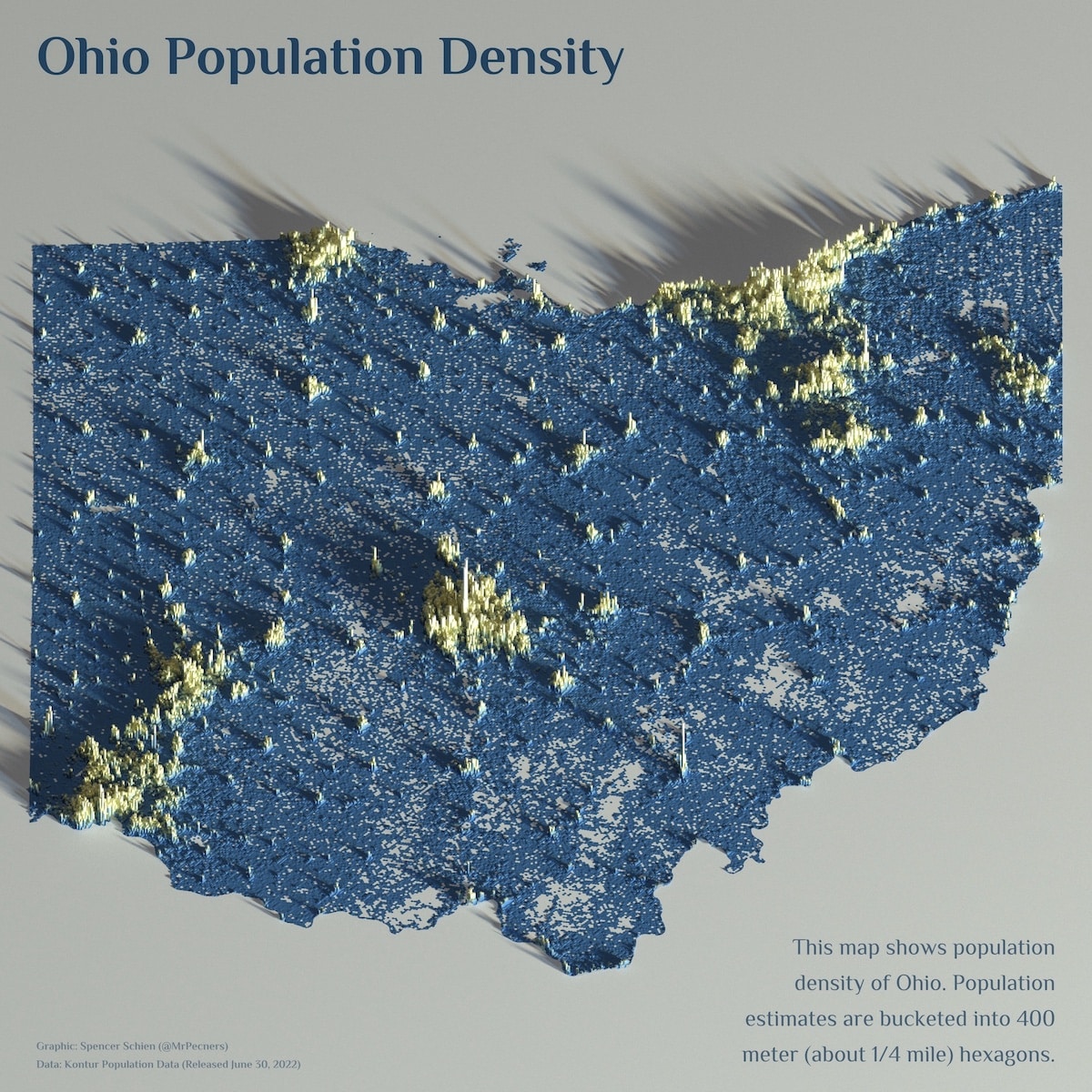
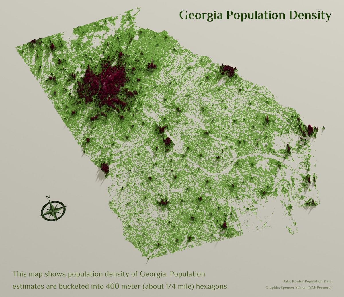
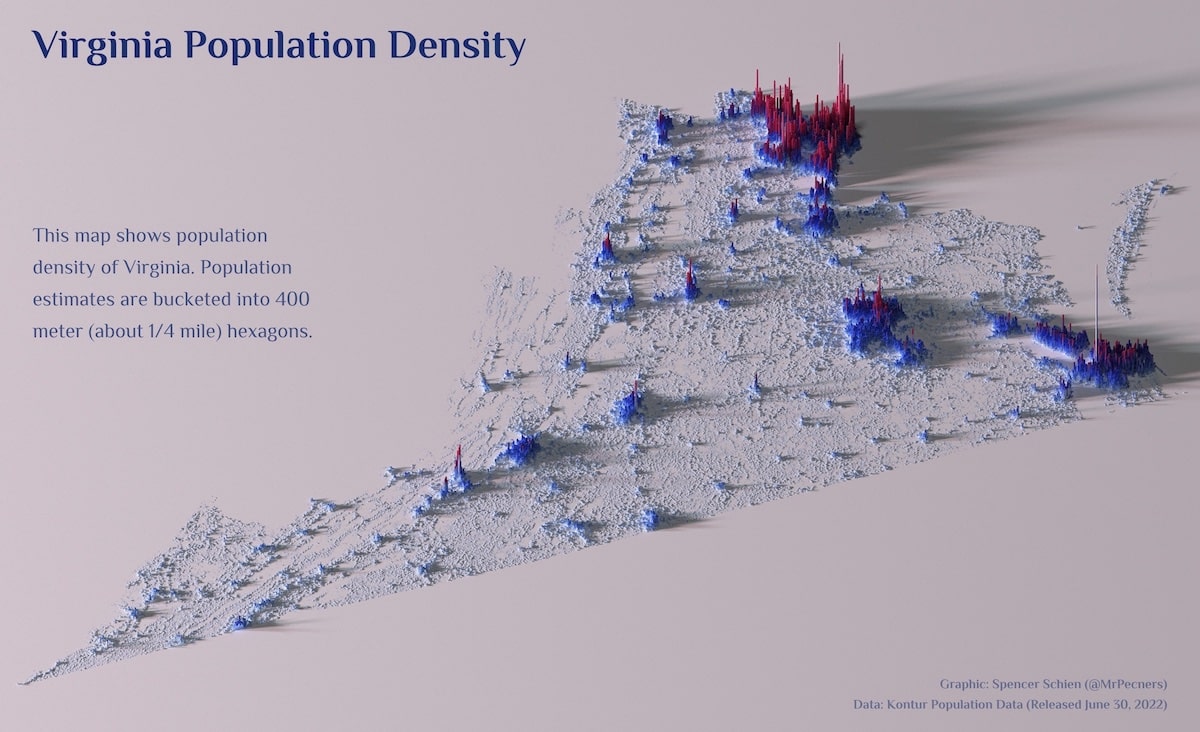
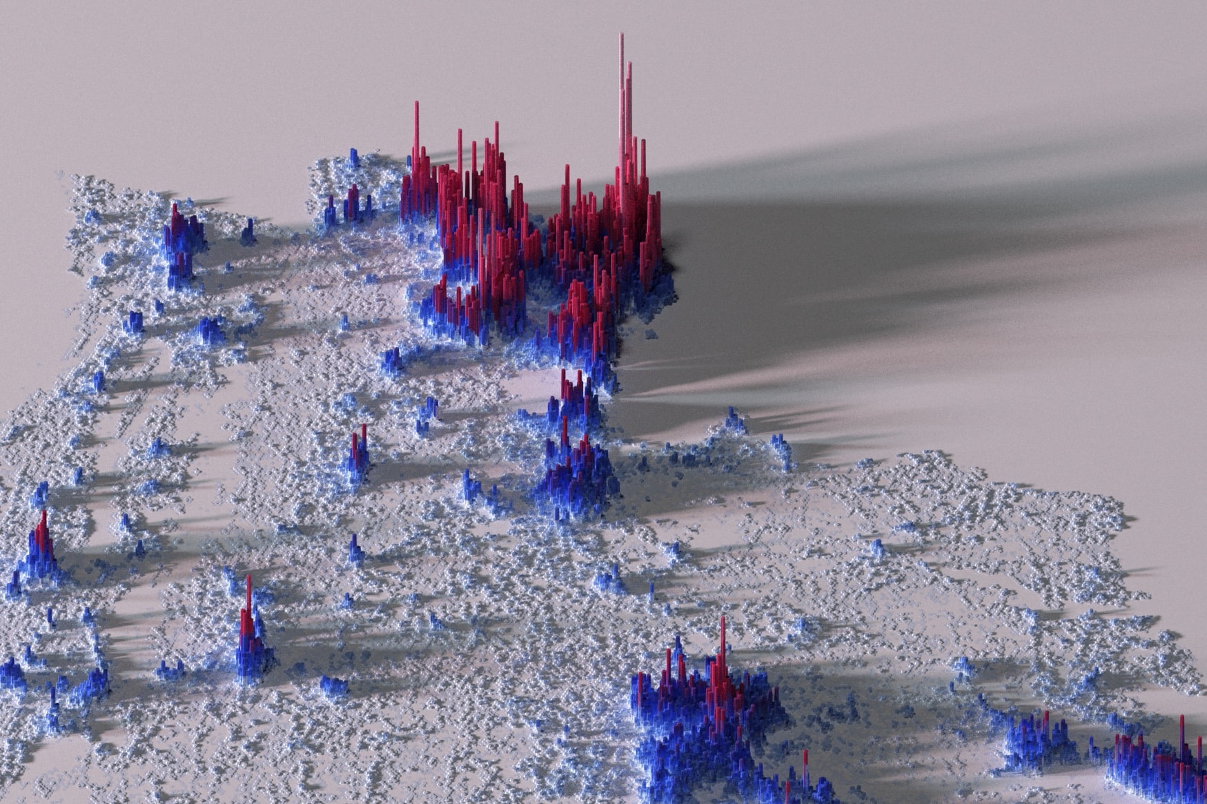
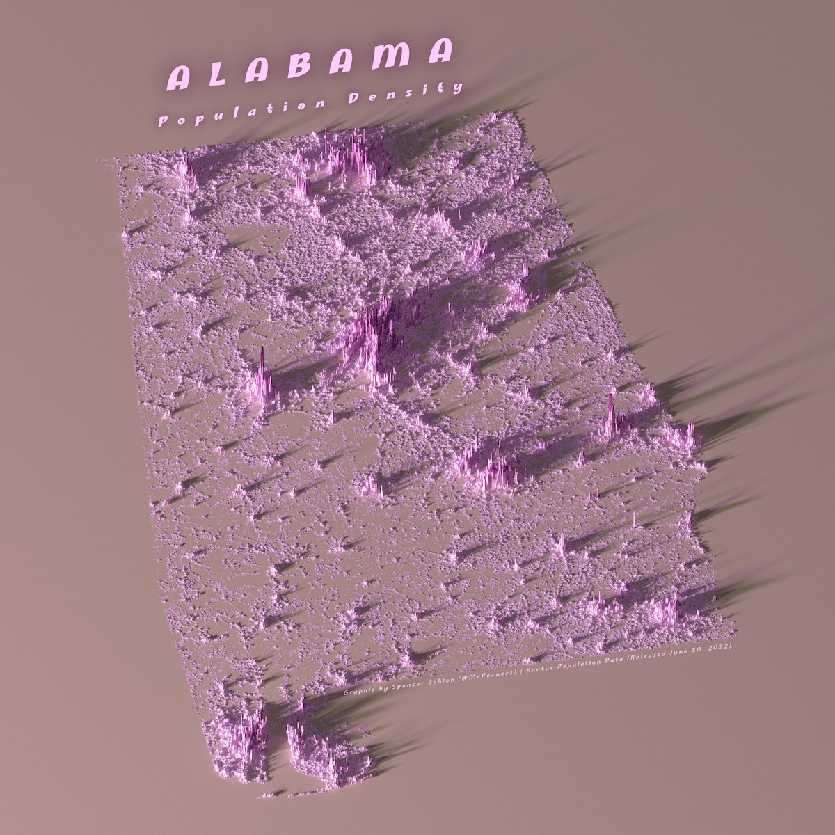
Data technologistSpencer Schienis demystifying a selection of U.S. states with his fascinating population density maps.
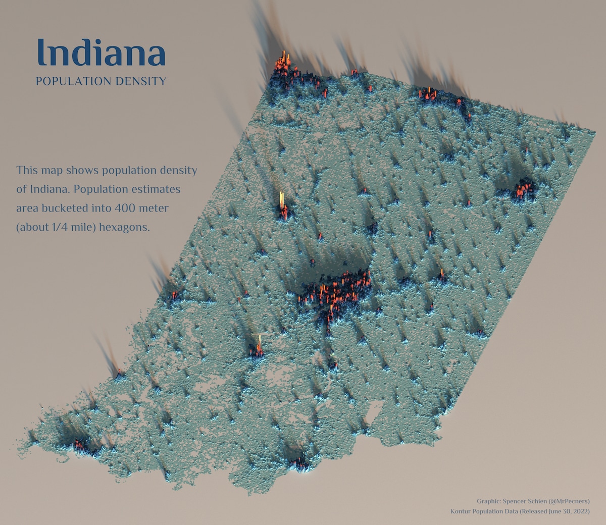
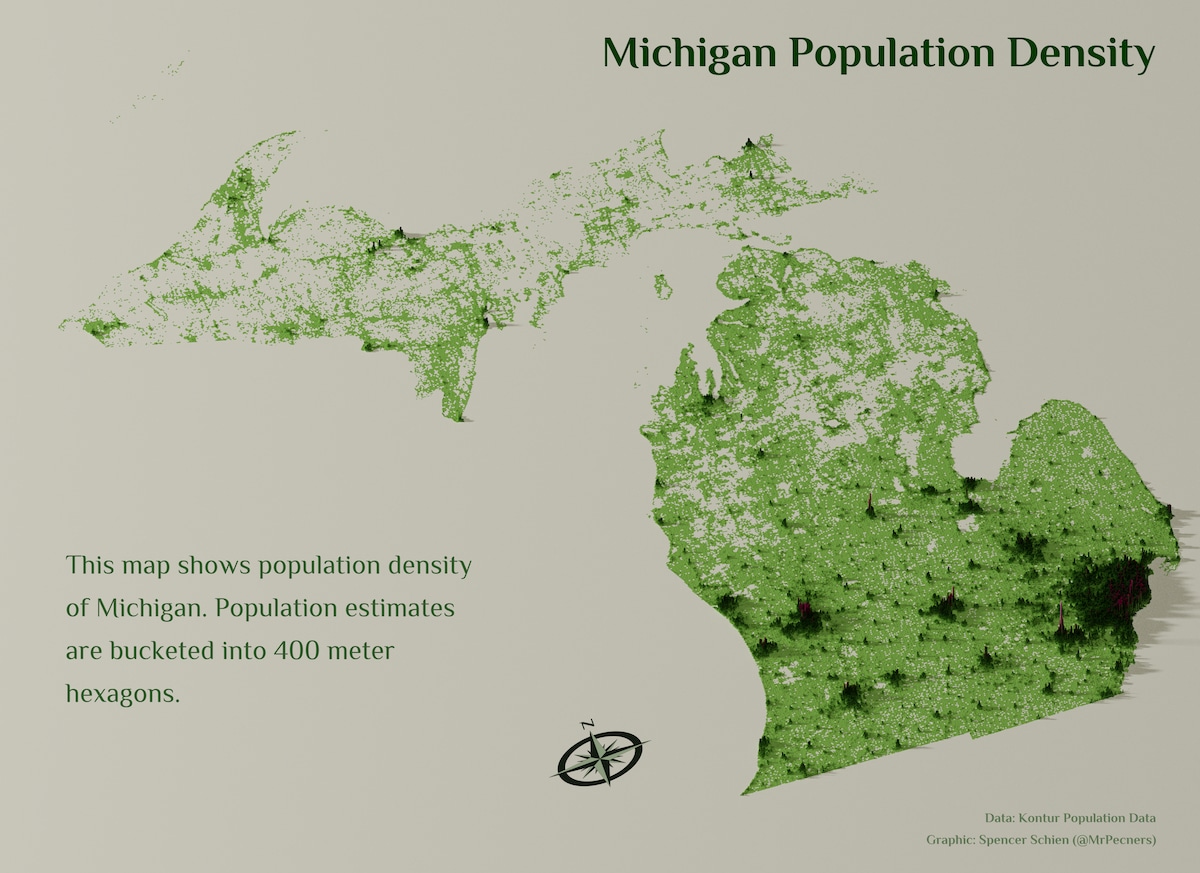
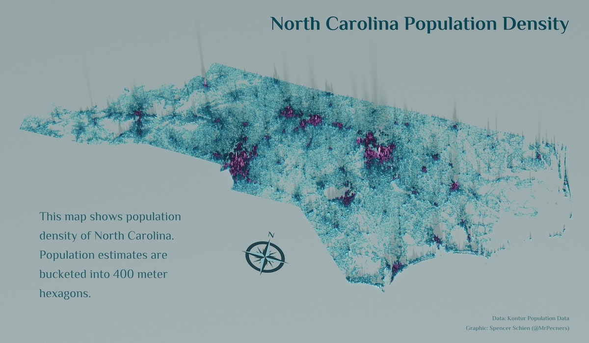
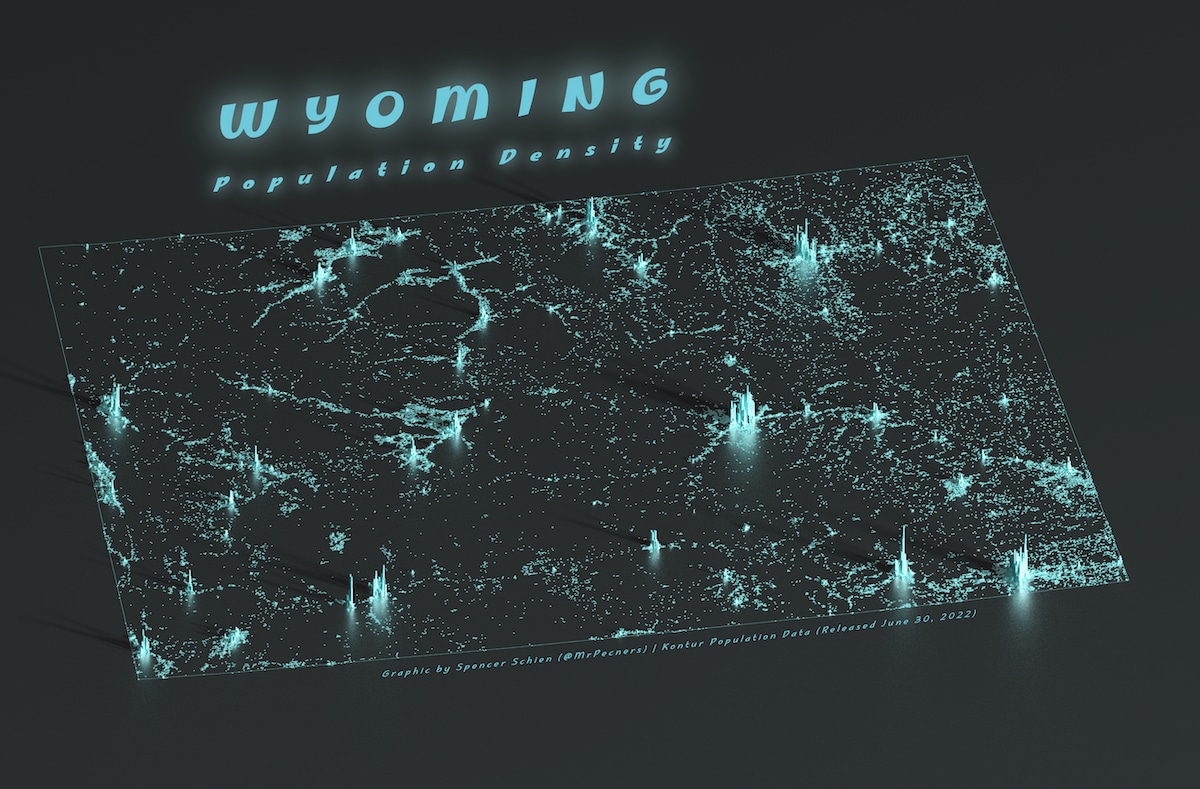
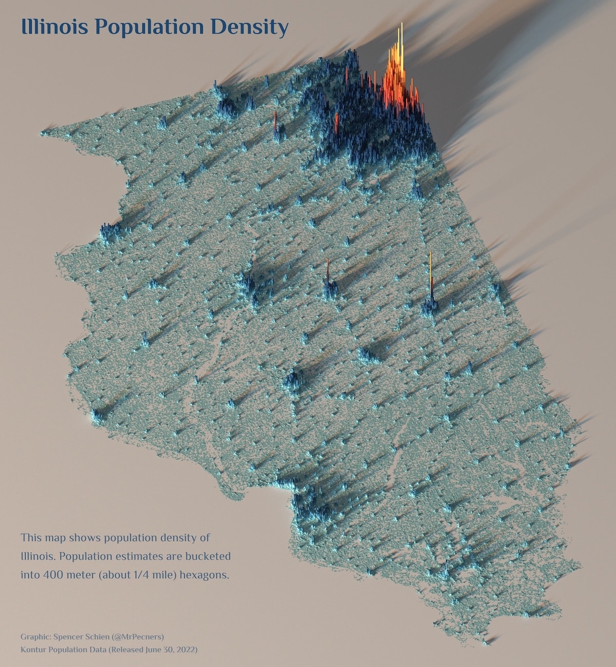
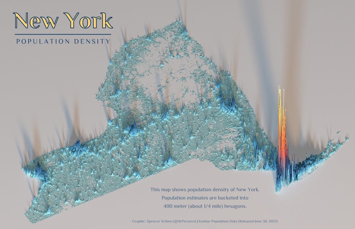
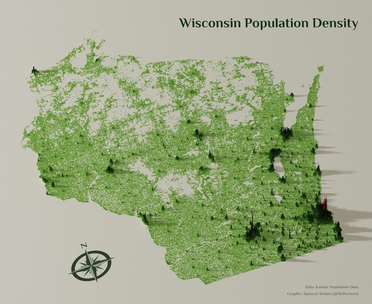
The more people there are, the higher these sites get, making them reminiscent of a topographical map.
Schien was inspired to make these maps as part of the#30DayMapChallengein November 2021.
The theme for day 21 was theKontur Population Dataset, he explains to My Modern Met.
His aesthetic was further inspired by the internet at large.
He plans to continue the project.
At this point, I think I’ll probably do all the states.
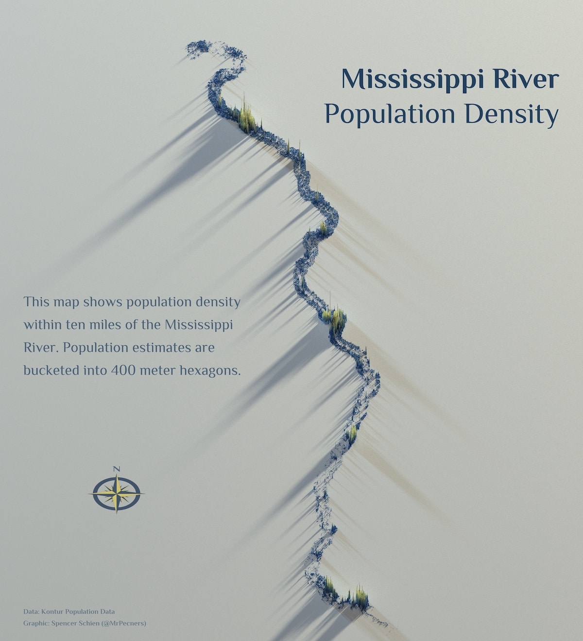
I also like to come up with creative ways to portray the data beyond standard administrative boundaries of states.
To see what Schien is working on next, follow him onTwitter.
Data technologist Spencer Schien is demystifying a selection of U.S. states with his fascinating population density maps.
They make it easier to differentiate urban areas from rural areas.
Schien intends to continue the project with more states, cities, and areas.
Related Articles: