This post may contain affiliate links.
If you make a purchase, My Modern Met may earn an affiliate commission.
like readour disclosurefor more info.
This post may contain affiliate links. If you make a purchase, My Modern Met may earn an affiliate commission. Please readour disclosurefor more info.
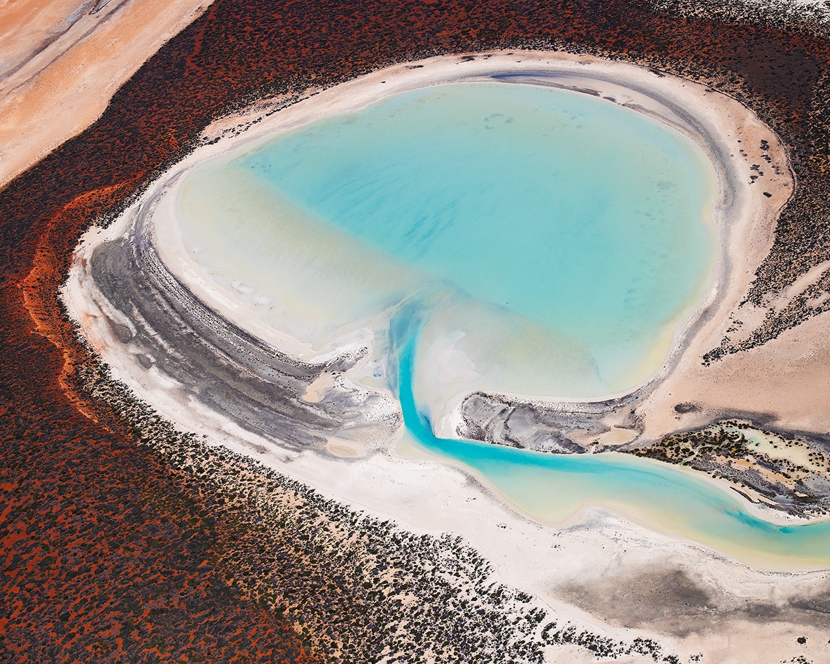
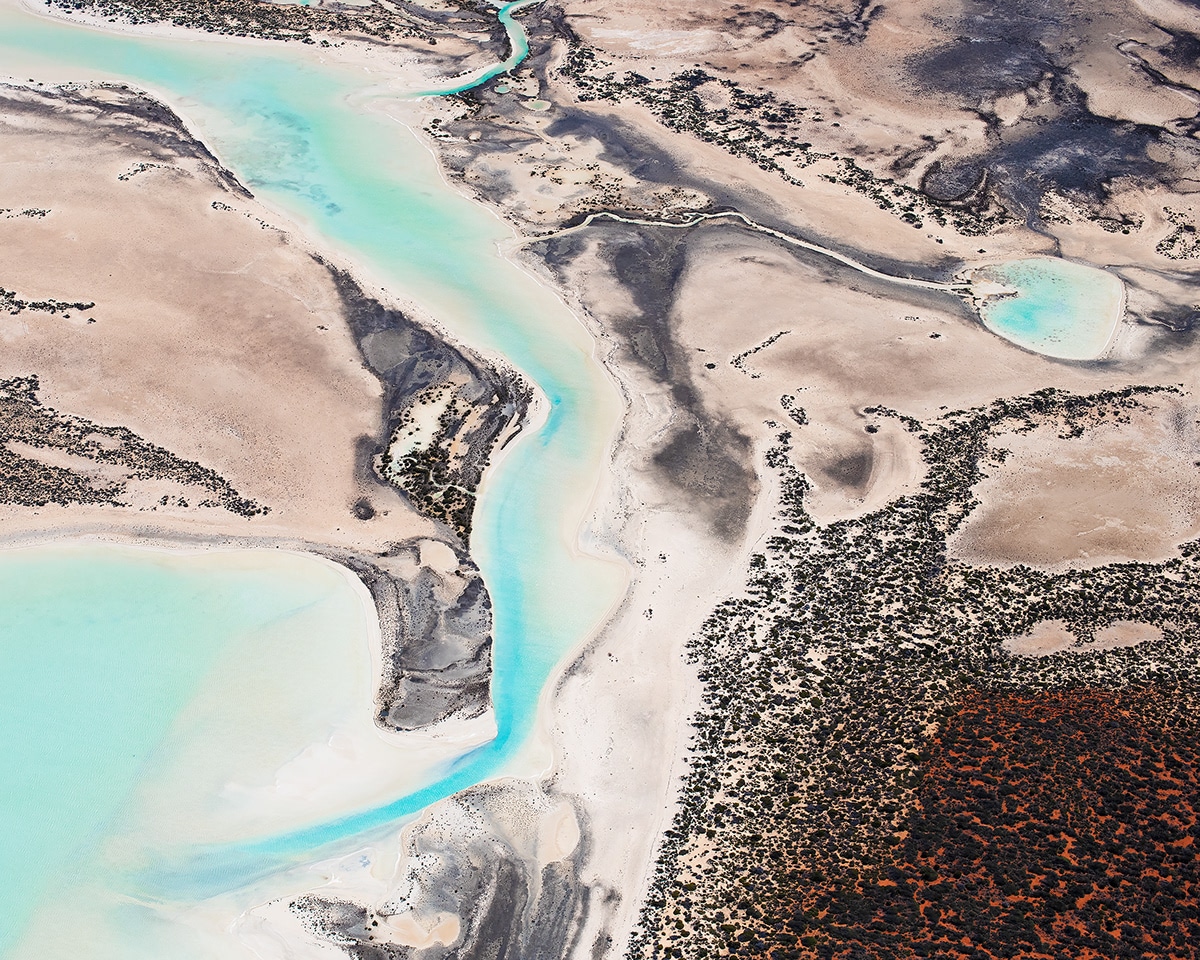
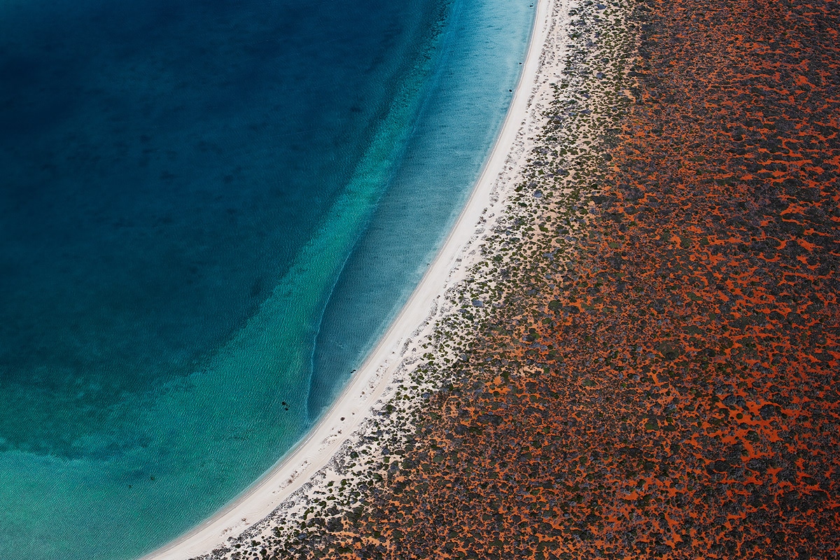
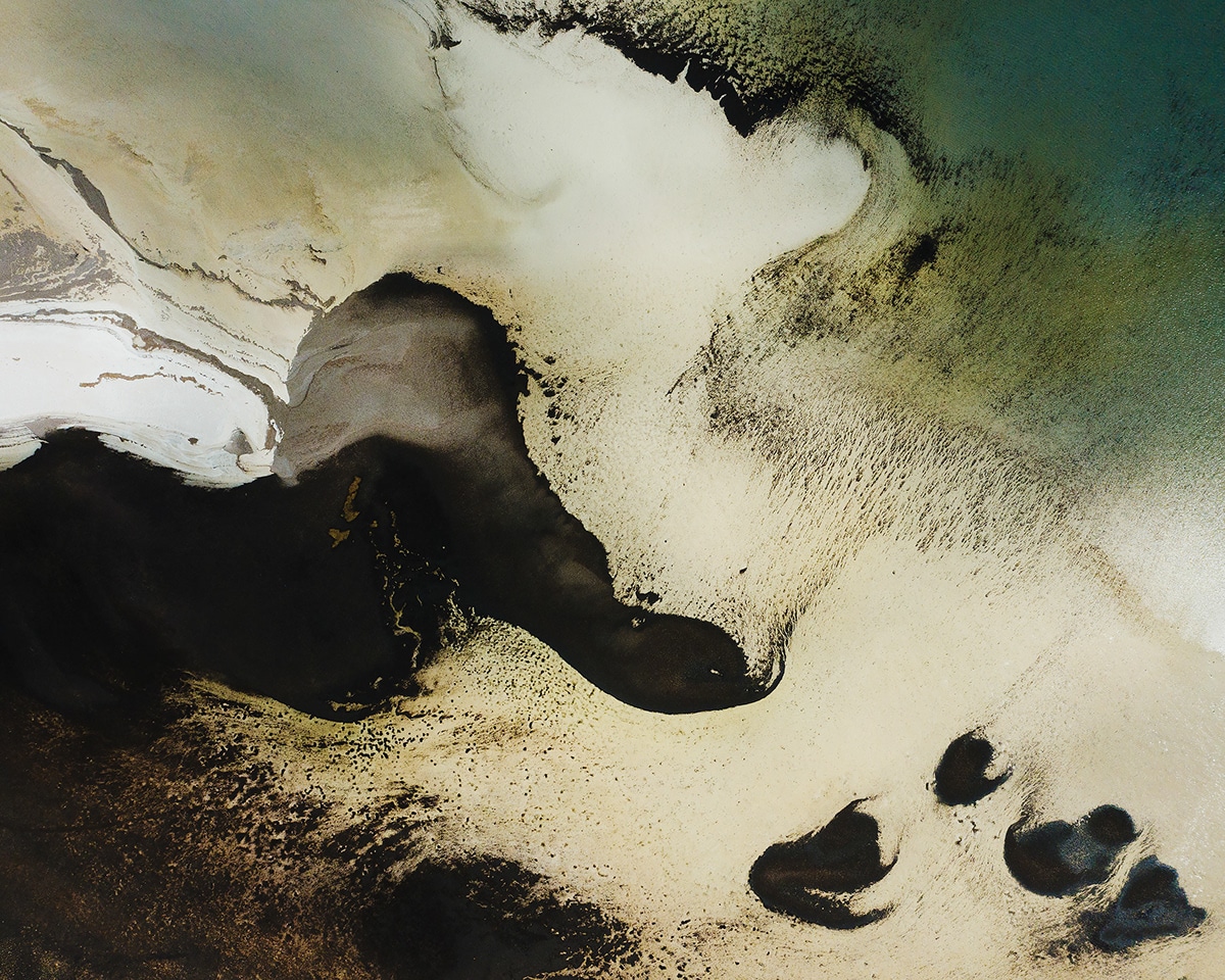
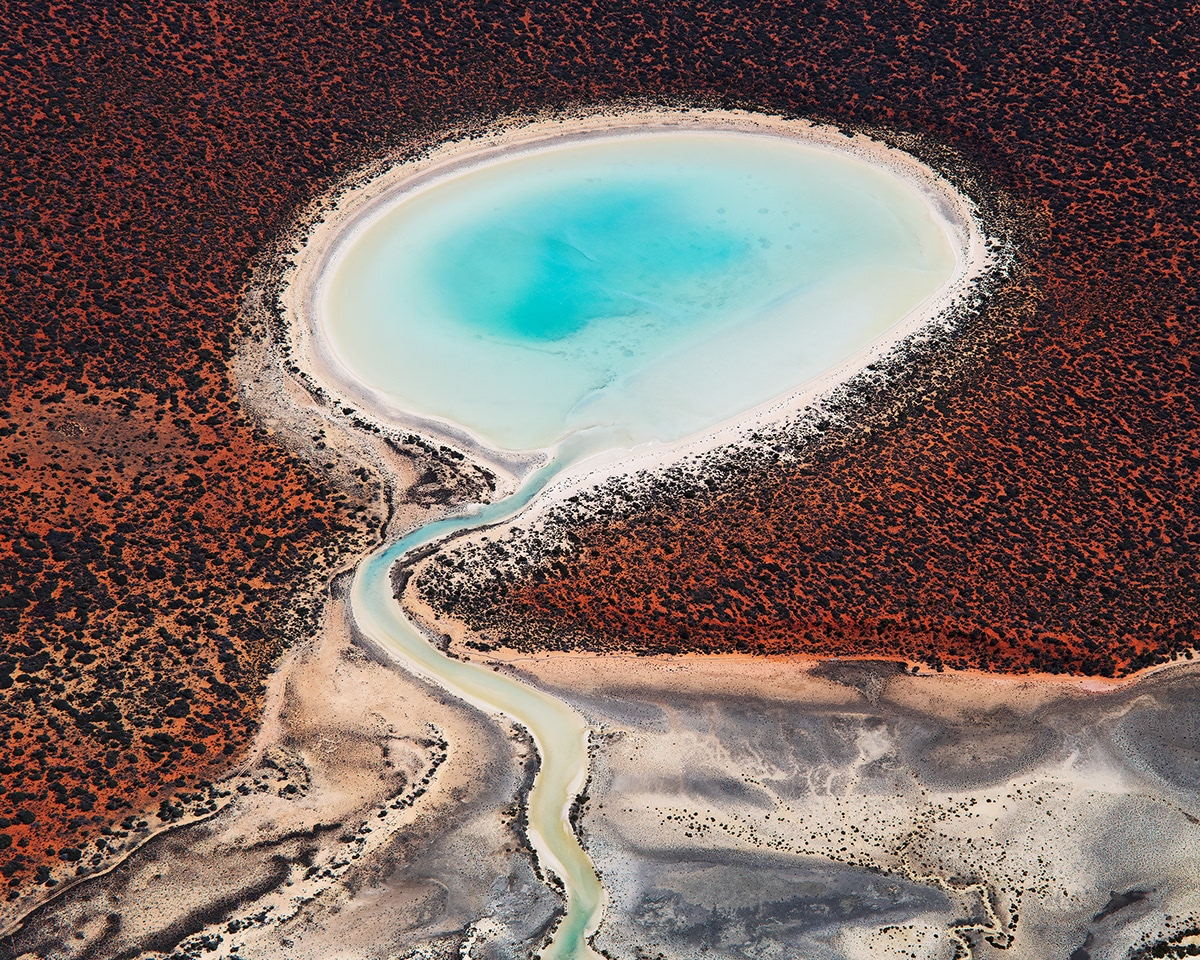
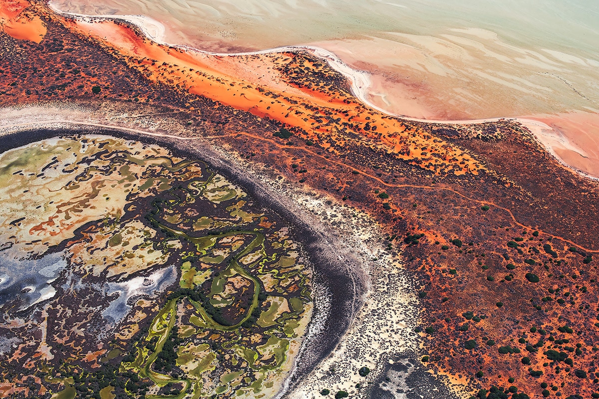
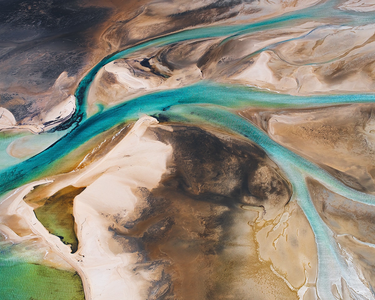
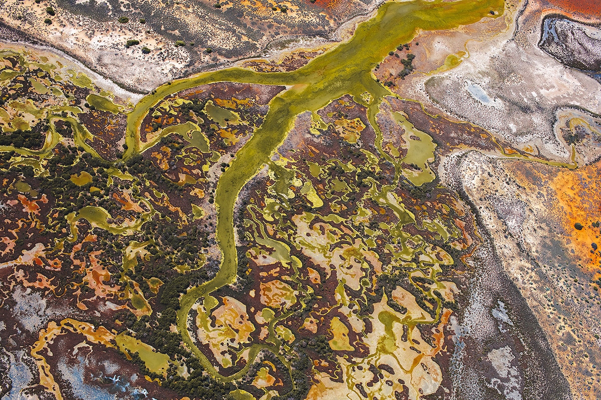
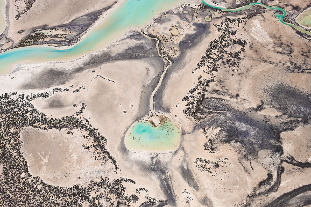
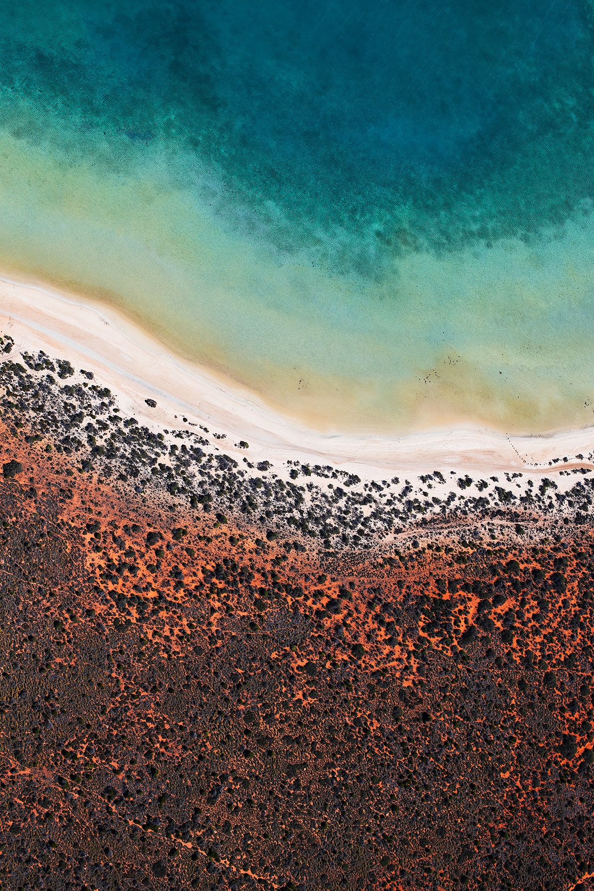
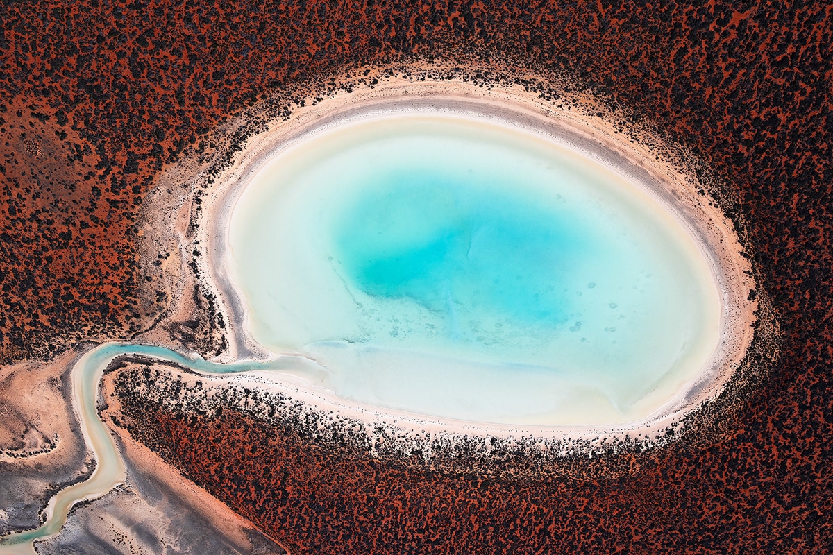
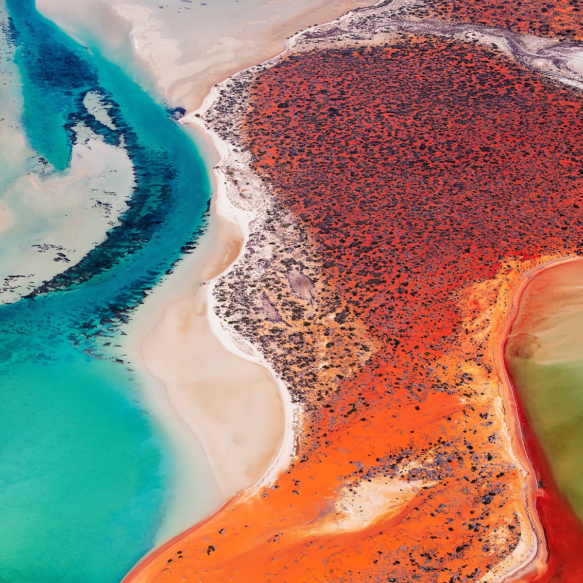
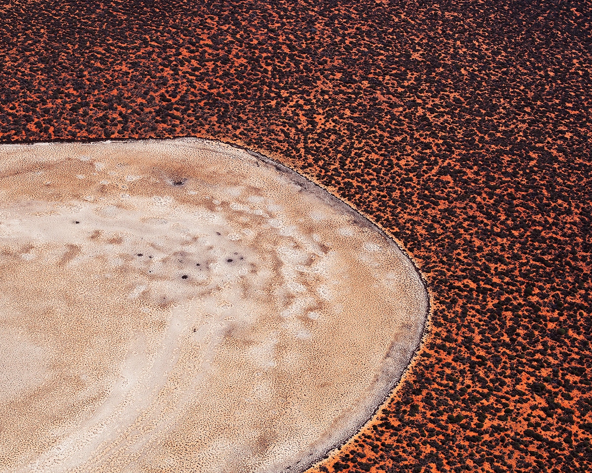
Viewed from the sky, Shark Bay is a strangely organic landscape, says Berbigier.
It’s like looking down a microscope at the cellular structure of the continent.
The connection of land and life is evident in this ancient place, he says.
We recently caught up with Berbigier to ask about his experience shooting Shark Bay from above.
Read on for My Modern Met’s exclusive interview.
How did you first get into photography?
A little more than a decade ago, I got into photography after the start of the digital era.
With this came the first photography sharing platforms.
A new way of discovering the work of thousands of creative photographers, only one click away.
That really helped me with composition, in camera and post-processing techniques.
Browsing, trying new things, publishing, and getting feedback.
I have never used a film camera.
Do you remember the first landscape you photographed?
I dont, but I do remember the first landscape photograph which got me some attention.
The photo depicted one of the rock pools around Sydneys beaches.
A long exposure with a late blue hour atmosphere.
The long exposure and dark blue light made it look incredibly surreal.
I have a lot of long exposure photographs in my portfolio.
Why did you decide to shoot yourShark Bayseries from above?
Australia has some of the most incredible landscapes in the world.
Its one of the few remaining countries with endless, wild, and colorful landscapes.
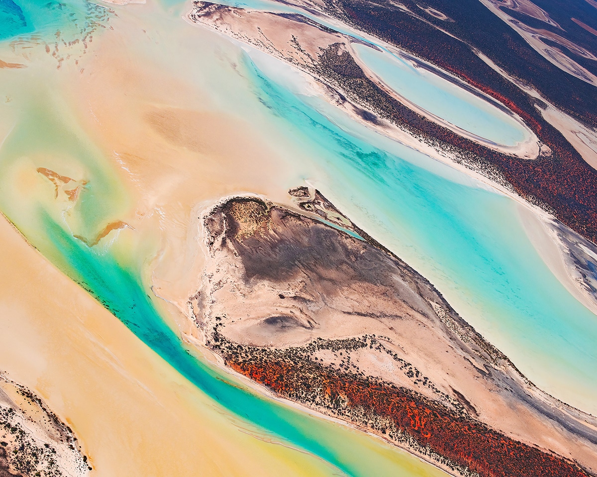
Shark Bay is a World Heritage listed site.
The diversity of its landscapes within a twenty five kilometers radius makes it a must visit for aerial photographers.
You wont find landscapes like these anywhere else.
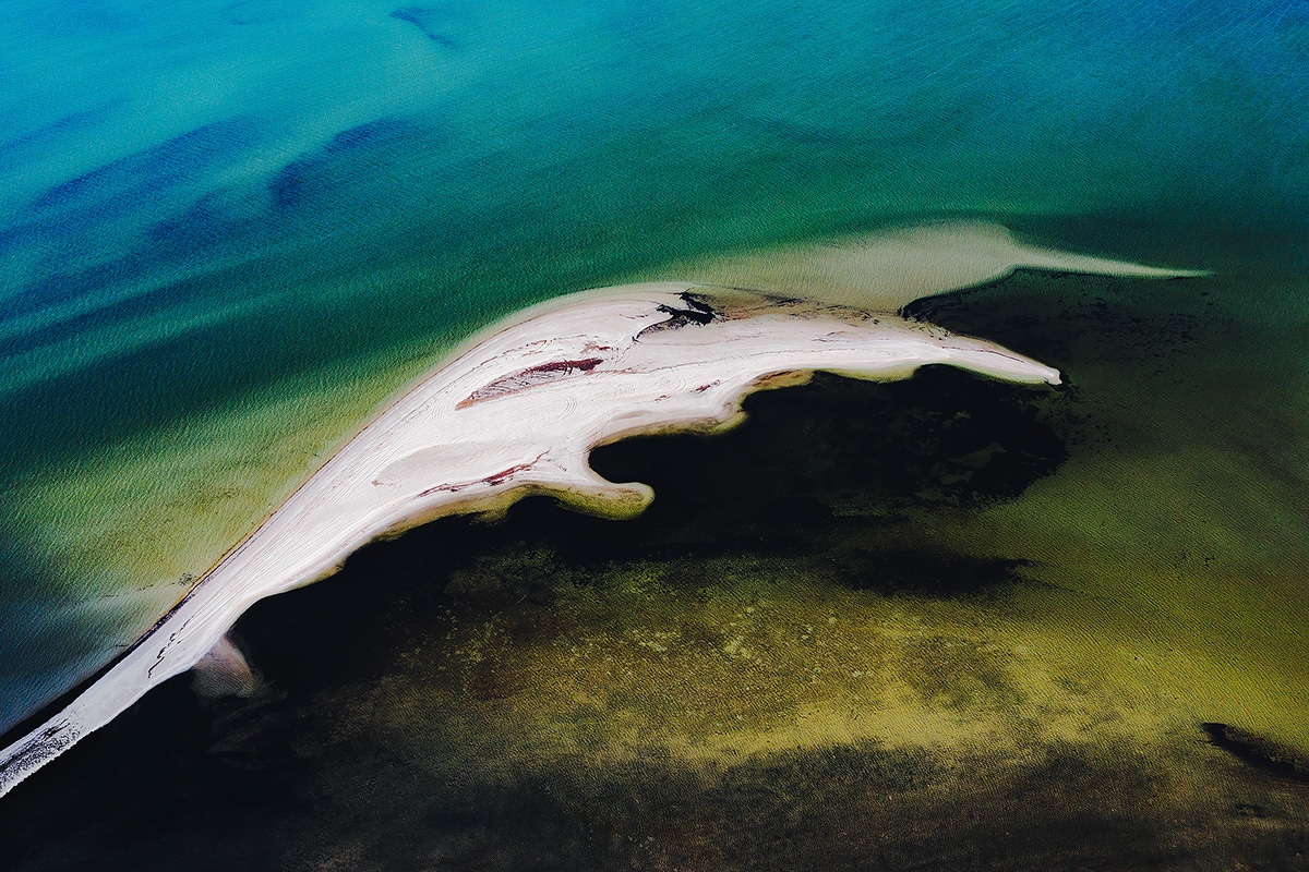
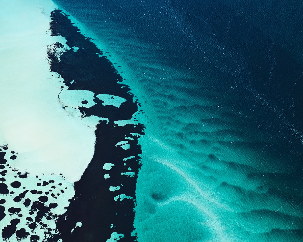
I found it fascinating how the landscapes of Shark Bay seem to be alive, from geology to biology.
Can you describe your process for achieving your aerial photos?
The plane flew mostly at 1,500ft, the perfect altitude for most of Shark Bays landmarks.
I used aNikon D850andNikkor 50mmprime lens for this series.
For aerial photography, you want high resolution and speed.
Depth of field matters less as you often shoot straight down (looking at a flat surface).
Some photographers hire super high resolution cameras (e.g: Phase One).
For 1.5m prints, I had more than enough pixels on the Nikon D850 (46M).
The prime lens helps with the speed and sharpness.
I also packed a drone, only two images in the series are shot with it.
The drone is great when the plane isnt an option.
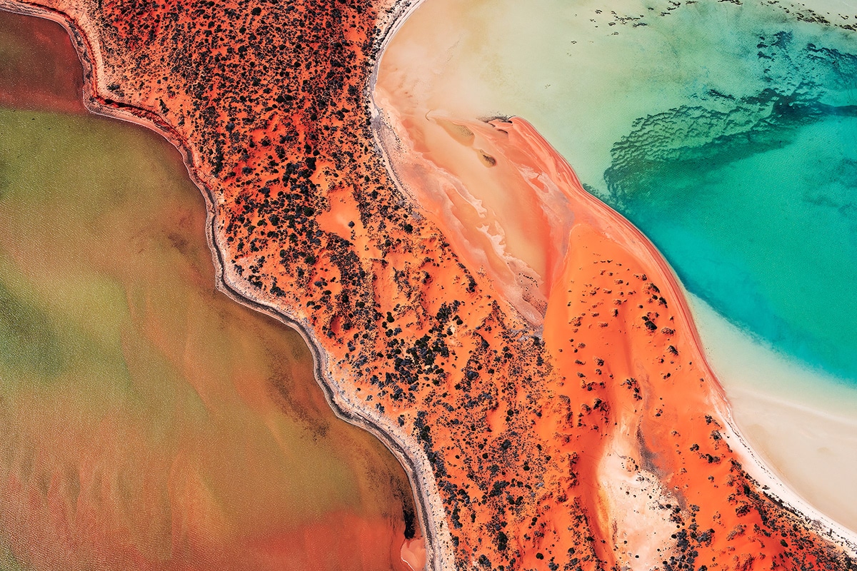
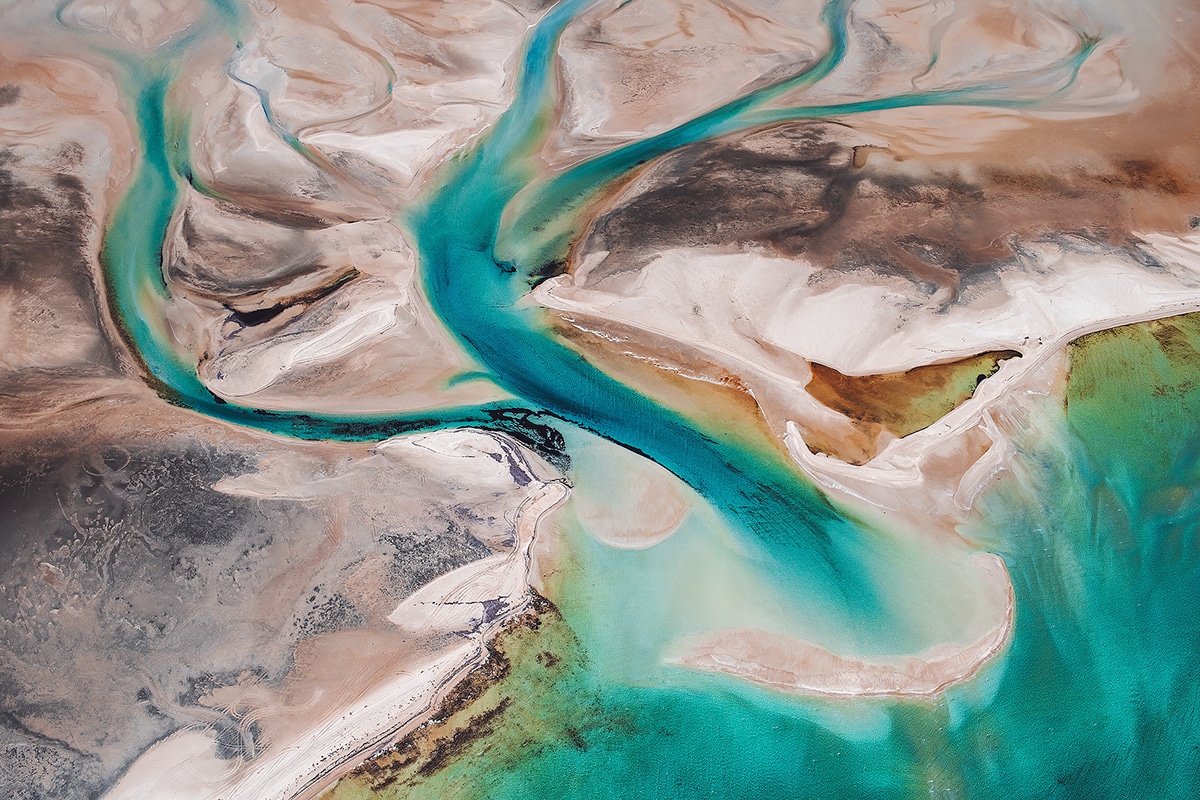
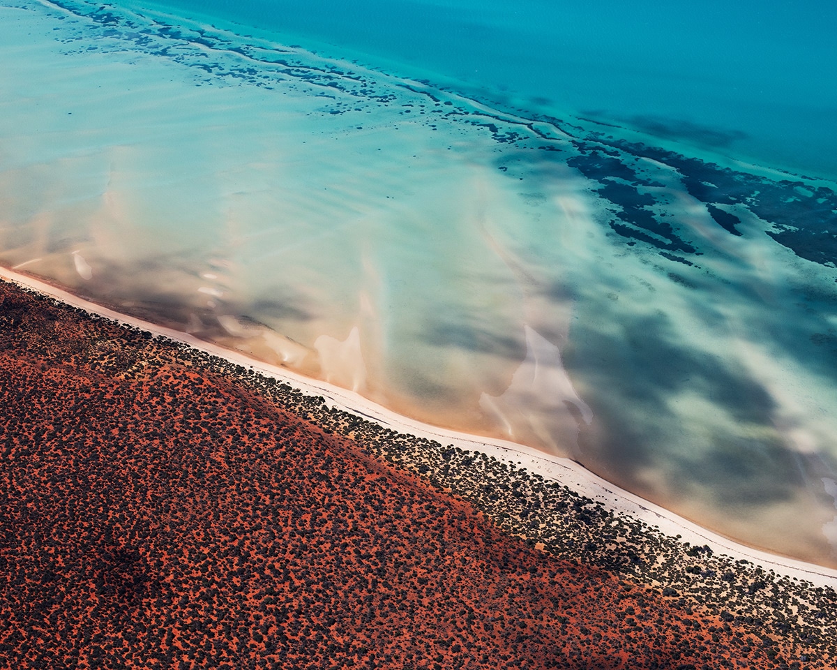
Why do you think you’re drawn to capturing the land and the sea?
I am not sure, but nearly all my photos have land and sea in them.
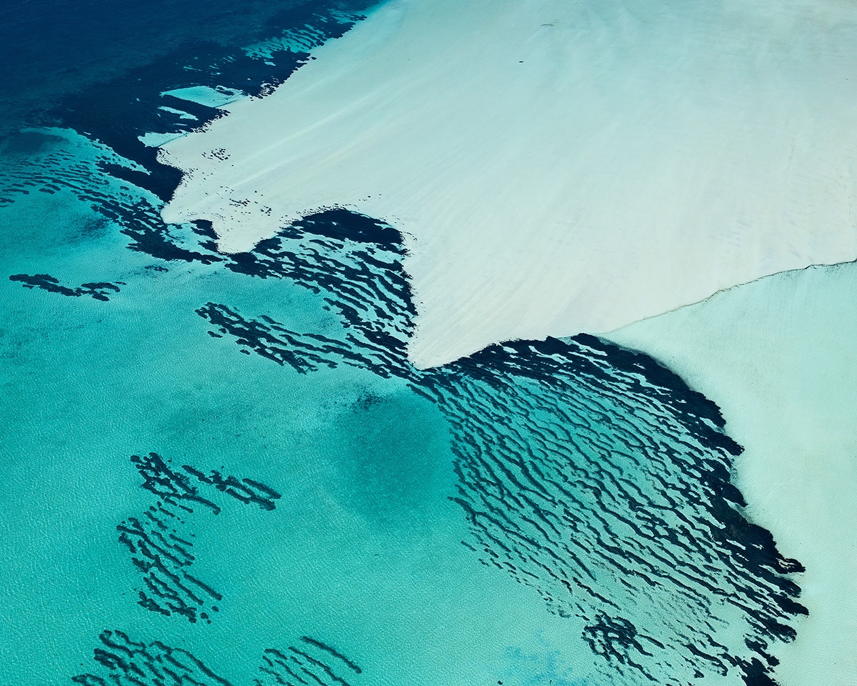
InShark Bay, the colors are the most impressive where the land and the water meet.
In the shallows are the highest contract and most beautiful patterns.
Where would you like to photograph next?
I wouldnt mind going from hot to cold, and head towards the mountains.
Chile would be on the list, and Patagonia of course.
But I also wonder how many incredible places are untouched in regions like the Middle East.
Pakistan for example has incredible landscapes.
Related Articles: