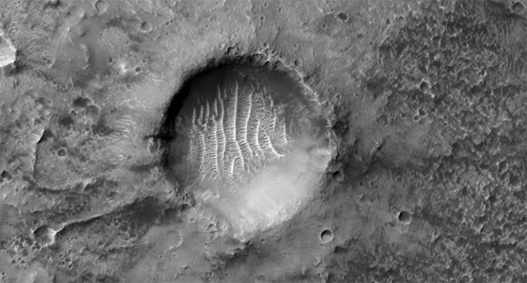
The crater which marks longitude zero on Mars.
(Photo:NASA/JPL/University of Arizona)
Mars has long fascinated astronomers.
Onboard the orbiter isHiRISE, a sophisticated imaging system which documents the surface of the planet.
The crater which marks longitude zero on Mars. (Photo:NASA/JPL/University of Arizona)
The high-resolution images are then returned to Earth.
Over the years, the camera has documented dunes, craters, and even the Mars rovers.
Its latest image shows a particularly special feature of the planetary topography.
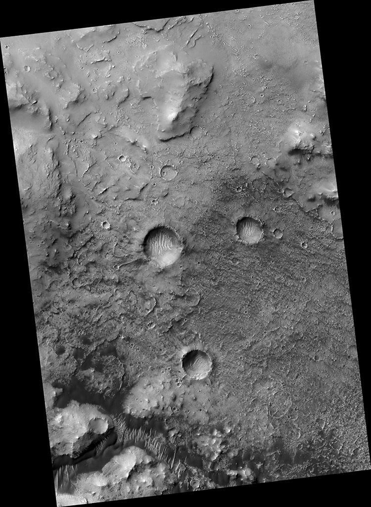
The crater which marks longitude zero on Mars is at the center of the image. (Photo:NASA/JPL/University of Arizona)
The image depicts several smaller craters inside a much larger one.
The larger indentation used to serve as the zero longitude mark on the planet.
Longitudinal lines measure how far east or west a point is on a planetary surface.
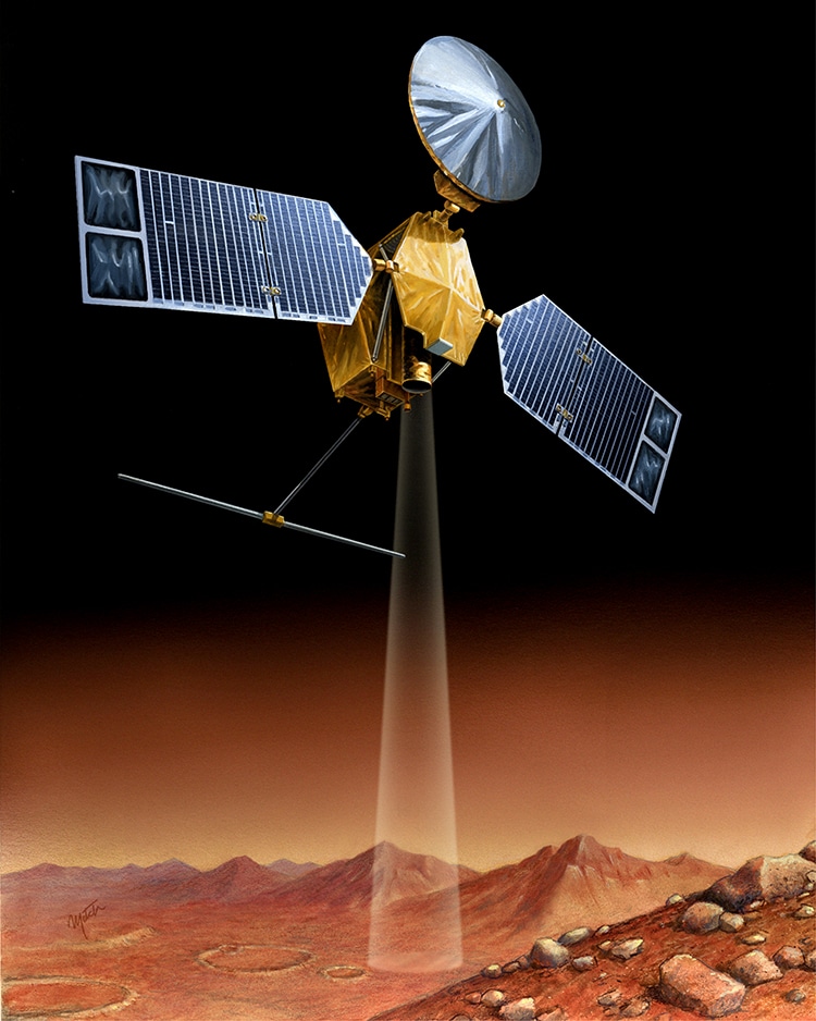
An artist’s visualization of HiRISE surveying the surface of Mars. (Photo:NASA/JPL, Public domain)
To measure, there must of course be a place that serves as ground zero.
On Earth, that place is theGreenwich Observatoryin Greenwich, UK.
The line which runs vertically through the observatory is known as theprime meridian.
On Mars, the meridian originally ran through the larger crater.
However, recent technology has necessitated zooming in.
Inside the crater, a smaller central divot now serves as a point of reference.
The crater is filled with rippled dunes, created by wind in the atmosphere.
These marks are clearly visibleand rather beautifulin the images released on January 20, 2022 from HiRISE.
The images themselves were taken at the end of 2021.
The crater which marks longitude zero on Mars is at the center of the image.
An artist’s visualization of HiRISE surveying the surface of Mars.
