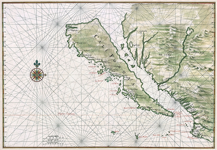
Map by Johannes Vingboons, circa 1650.
(Photo: Library of Congress viaWikimedia Commons, Public domain)
California is known for many things.
San Francisco cablecars, Hollywood celebrities, and the rolling vineyards of Napa Valley are among its iconic symbols.
Map by Johannes Vingboons, circa 1650. (Photo: Library of Congress viaWikimedia Commons, Public domain)
Cartographers showed California as an island.
This misconception came about in the earliest days of European exploration along the west coast of the continent.
On early 16th-century maps, California was, therefore, drawn as an island.
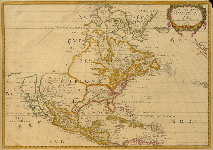
“Amerique Septentrionale,” map by Nicolas Sanson, 1650. (Photo: UTA LibrariesCartographic ConnectionsviaWikimedia Commons, Public domain)
Depicted with colorful designs, the Gulf of California became a channel.
Whilesome cartographersdid get it right geographically, this was not the norm.
Eventually, 18th-century explorers and cartographers finally corrected this European misinterpretation on a wider scale.
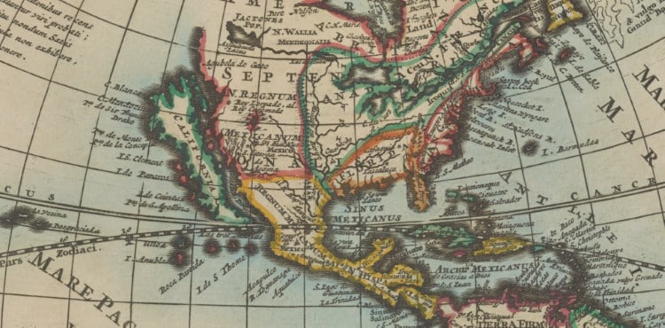
Detail of a 17th-century world map by Pieter van der Aa. (Photo:Stanford Libraries,PDM 1.0 DEED)
Amerique Septentrionale, map by Nicolas Sanson, 1650.
Detail of a 17th-century world map by Pieter van der Aa.
Learn More About the Inventor of the Worlds First Atlas
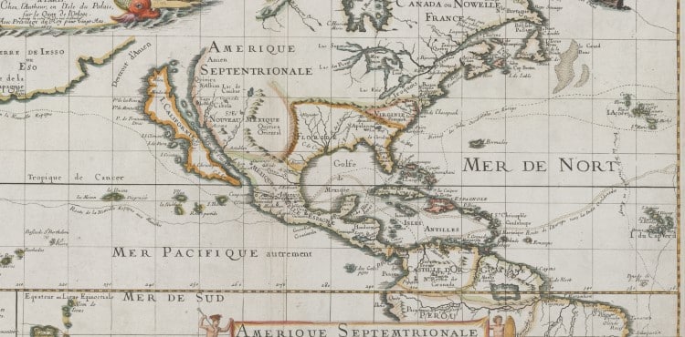
Detail of a 17th-century map by Pierre Duval (Photo:Stanford Libraries,PDM 1.0 DEED)
